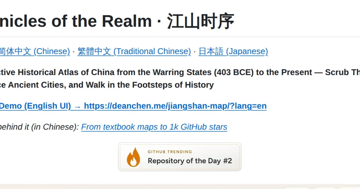
On November 13, 2026, open-source Chinese historical atlas jiangshan-map (DeanChensj/jiangshan-map) shipped v1.3.0 on GitHub Releases, completing four major versions in less than four weeks since v1.0.0 launched on October 17. Beyond its parchment-style browser interface, the release highlights a deliberate architectural choice: rather than asking LLMs to generate map polygons or invent coordinates, the project packages 2,400 years of curated spatial records as a deterministic co-processor for AI agents.
Four Releases in Four Weeks: From Static Dynasties to Two-Camp Sandboxes
Reading the release history from v1.0.0 through v1.1.0 (October 27), v1.2.0 (November 3), and v1.3.0 shows a clear shift from passive territory browsing to structured historical simulation. Territory snapshots expanded from 164 to 183, 189, and 198 phases; timeline milestones grew from 395 to 471, 485, and 526; and person chronicles scaled from 7 journeys to 104 and now over 124 figures (with llms.txt listing 125+), backed by 110 polity profiles, 1,753 ancient settlements, and coverage of all 349 modern Chinese prefecture-level divisions.
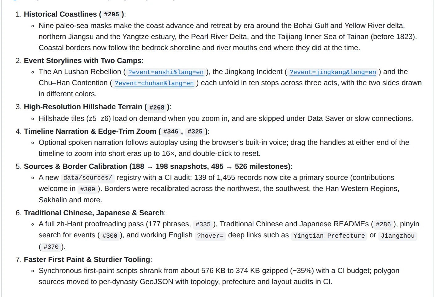
With v1.3.0, the project moves into physical shoreline evolution and dual-faction campaign dynamics. Nine paleo-sea masks shift coastlines and river mouths across eras, while the new Event Storylines mode breaks the Chu-Han Contention, An Lushan Rebellion, and Jingkang Incident into 10 stops across three acts, color-coding opposing march routes and switching dynastic base maps automatically. The release also layers in on-demand z5-z6 hillshade terrain tiles (from 2 km to 1 km per pixel via SRTM, GMTED2010, and ETOPO1) that skip automatically under Data Saver, browser speech synthesis that dips background guqin music during narration, 16x edge-trim timeline zooming for brief dynasties, a 177-phrase Traditional Chinese proofreading pass, Japanese docs, and pinyin search for events.
Technically, the codebase stays disciplined. Written in plain JavaScript with SVG and Canvas rendering and zero heavy framework dependencies, it shrank synchronous first-paint scripts by 35%, from roughly 576 KB to 374 KB gzipped, moved polygons into per-dynasty GeoJSON sources, and wired topology, prefecture, and layout checks into CI.
Splitting Semantic Extraction From Deterministic Cartography
When language models help readers unpack classical texts or poetry, spatial disambiguation is one of the fastest places for hallucinations to surface. An identical ancient place name often migrated hundreds of kilometers between dynasties. As the project's llms.txt specification points out, Jiangzhou in Qin-Han Ba Commandery refers to modern Chongqing, whereas Jiangzhou in Tang-Song Jiangnan West Circuit points to Xunyang in modern Jiujiang.
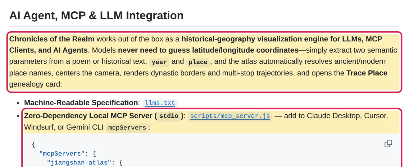
Instead of training or prompting models to emit latitude and longitude coordinates, jiangshan-map divides the pipeline cleanly. The LLM handles context-aware semantic parsing, inferring just two parameters from a passage: year and place. Coordinate resolution, dynastic base map switching, curved multi-stop arc drawing, and 2,400-year administrative genealogy stay locked inside deterministic code. Even complex trajectories such as Ming-era Wang Yangming (1472-1529) or converging multi-army routes separated by semicolons require zero coordinate math from the model.
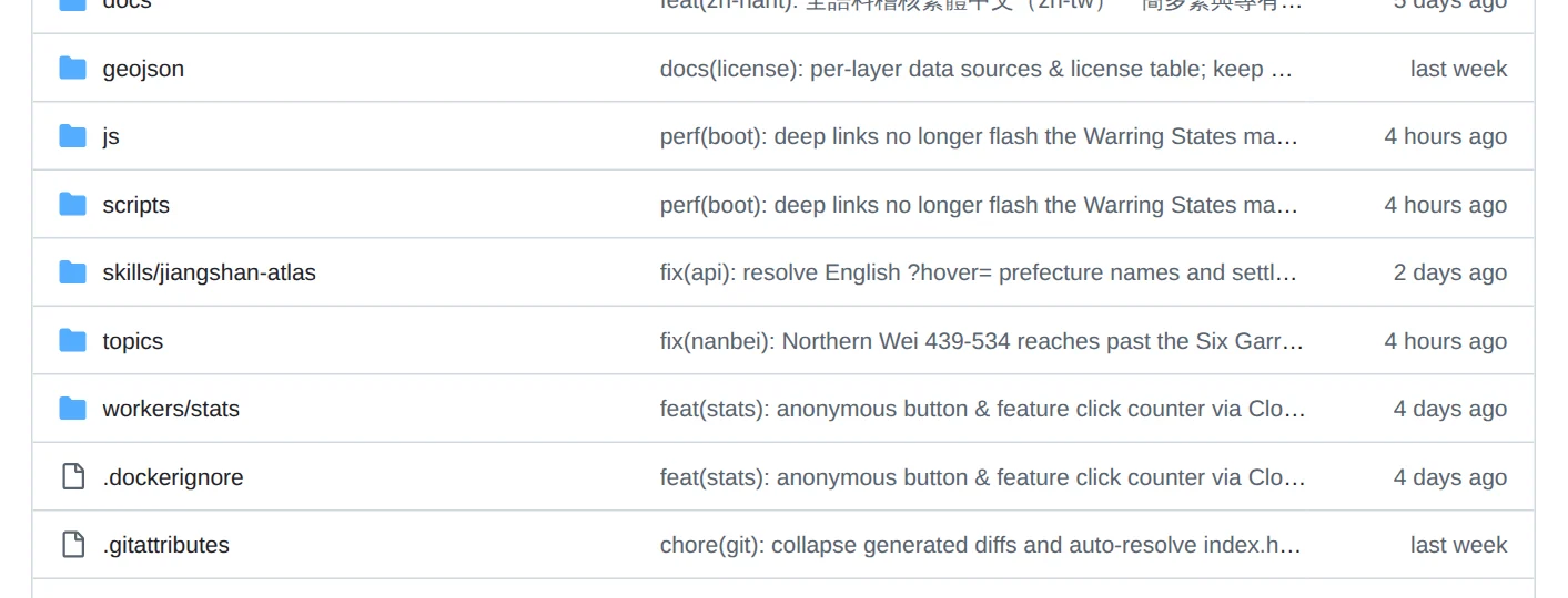
The integration surface is unusually thorough for a static web project. Agents can hit window.atlasAPI in Playwright, register via in-browser WebMCP (navigator.modelContext), run the skills/jiangshan-atlas CLI skill with jiangshan.py, query the zero-dependency local stdio MCP server (scripts/mcp_server.js) at under 5ms offline latency in Claude Desktop, Cursor, Windsurf, or Gemini CLI, or export standard RFC 7946 GeoJSON alongside geojson/jiangshan-locate.js for point-in-polygon lookups.
The Real Bottlenecks Are Citation Audits and Split Licensing
UI responsiveness and agent hooks shipped four major iterations in under a month, yet the hardest constraints in digital humanities software sit outside rendering speed. In v1.3.0, the maintainer introduced a data/sources/ registry with automated CI citation checks, revealing that only 139 out of 1,455 records across milestones, events, journeys, and historical figures currently link to a primary text across Shiji, Hanshu, Zizhi Tongjian, or Book of Sui, with crowdsourced verification tracked openly in GitHub issue 309. The live web atlas also cautions users that its historical borders are schematic approximations rather than surveyed boundaries.
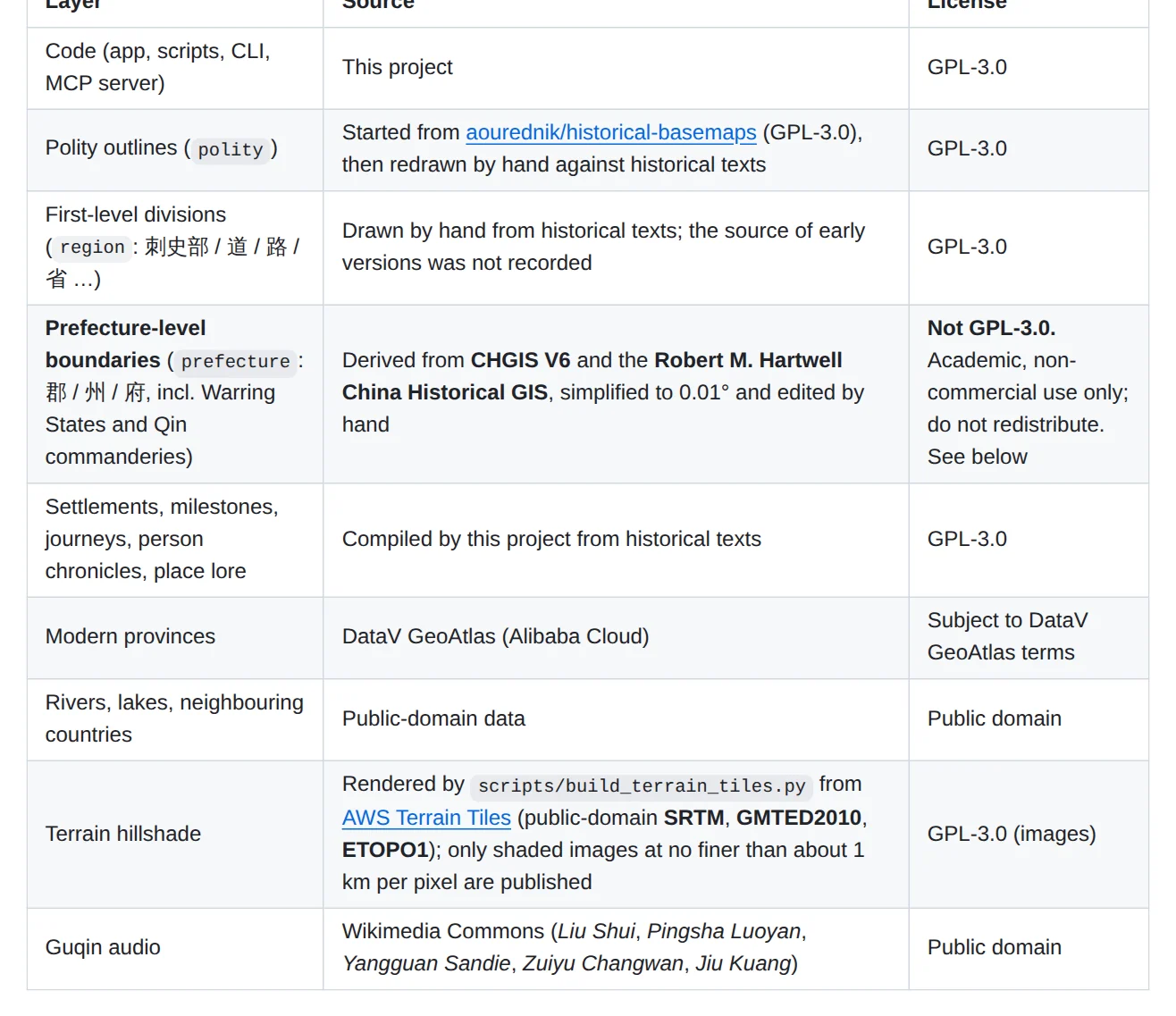
Data licensing draws a second structural line that commercial teams often overlook. Application code, hand-drawn polity outlines, terrain hillshade tiles, and project-compiled chronicles sit under GPL-3.0, while prefecture-level boundaries (simplified to 0.01 degrees) derive from CHGIS V6 and the Robert M. Hartwell China Historical GIS. Because CHGIS restricts redistribution and commercial deployment, the repository's scripts/export_geojson.js tool strips out the prefecture layer by default unless a researcher explicitly passes --with-prefectures for local academic study. The README also clarifies that Tan Qixiang's The Historical Atlas of China serves solely as a scholarly reference, with zero copyrighted map tiles or data redistributed.
What This Means for Vertical Knowledge Tools Built for Agents
Viewed across the broader AI tooling ecosystem, jiangshan-map makes a practical case against prompt-only generation in fact-sensitive domains. Keeping spatial truth in a compact local index, exposing deterministic endpoints through llms.txt, MCP, and semantic URLs, and isolating non-commercial scholarly datasets from redistributable code gives engineering teams a durable blueprint for building vertical knowledge tools that serve human readers and coding agents alike. Over the coming months, tracking how quickly primary citations climb past 139 of 1,455 records—and whether two-camp storylines expand to later eras like Ming—will show how far community verification can scale alongside agent tooling.
Sources & references
Copy the link to save or share this article.